Showing posts with label GIS. Show all posts

Tuesday, 30 June 2026

#604: QuickGIS

Andy Funnell has done a great job of collating a whole range of GIS tools into one place "for busy teachers" - and others.

It's called QuickGIS and is a Wordpress site that he has put together for the benefit of everyone.

Maps are shown in a series of categories.

A quick browse reveals some useful ones for teachers of all key stages. The 'Environment and Resources' tab for example takes you to various viewers and maps to explore ecosystems.

This ecoregions map is new to me, for example.

Sunday, 12 October 2025

#505: NBN Atlas for butterfly data

Check out the atlas here for all things butterfly... 


Thursday, 28 November 2024

#405: Biome viewer

Thanks to Hannah Steel for the link to this useful visualisation tool.

Biomeviewer displays a range of information in a visual way.

It's really useful for identifying biomes in a general way, and rotating the globe to see where they are located and identifying their characteristics.

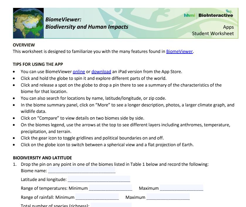
There are accompanying resources in a folder, student worksheet and apparently an iOS app too.

The worksheet takes students through the various features which are built into the app.


You can also explore anthromes: anthropogenic biomes. These are where the majority of humanity lives.

A classification proposed by E.C. Ellis, October 25, 2005 lists them. Minimum mapping scale greater than or equal to one square kilometer.


There is a lot more information and some useful maps on this website too, which is the new home of the previous link. Lovely work and I now want to do something with this as well...

Friday, 15 November 2024

#396: Living England 2022-3 Habitat Map

Visit the link, and see the details in the technical report.


Friday, 9 August 2024

#354: Saltmarshes

An interesting piece in Geographical magazine looked at the vital role that saltmarshes will play in mitigating sea level rise caused by Climate change.

I am fortunate to live in Norfolk and can be at a salt marsh within 25 minutes of leaving my home. They are wonderful places and last month came into bloom with sea lavender and other plants cloaking them in colour.


You can find their locations using the MAGIC application which I have blogged about here separately.

Image: Flowering plants on salt marsh in Norfolk, by Alan Parkinson, shared under CC license.

Thursday, 22 February 2024

#242: MAGiC Map - a free resource for GIS work

MAGiC is an interactive map. It is produced by DEFRA with a range of other organisations.

The GI stands for Geography Information - it's a GIS.

There are a series of layers of information which can be added to the base map.

Here's a map made by turning on the Habitats > Coastal > Saltmarshes layer, for example. This is very easy to do and students could be asked to explore the map themselves or be given a step by step guide. It would make sense

This map shows the locations of saltmarshes around the Wash.


Similar maps can be created for a whole range of habitats by changing the overlays.

A general guide to the map is available here.

Tuesday, 30 January 2024

#229: Hedges in the news

Hedges were in the news with a report on the BBC News website by Helen Briggs saying that the length of the UK's hedgerows would go round the world ten times. It's based on some CEH data here.


Of course it used to be many times more, but miles of hedgerows have been lost - grubbed up to make more space, or to make larger fields to make farming more 'efficient'. Hopefully some protections are now put in place, and other new hedgerows can be planted - I noticed some going in on the edge of my Norfolk village last weekend.

The news article was picked up by a few Twitter accounts.

There are plenty of overlaps with the potential content of the GCSE Natural History specification. Hedges are a linear habitat. Their existence reveals landscape change and links to the past, including enclosure. They are important for biodiversity, and vary in form in different counties.

Hedgelink has also shared the link to the mapping which has been done by CEH. 

A comment on hedges from Robert MacFarlane to end this post. We will certainly be coming back to consider how we can create a resource related to the changing history of hedges. They need to be conserved and cherished according to this FT piece.

I like the description here by Robert of hedges:

He asked for contributions on the theme of hedges, and here is one that caught the eye, and is worth returning to:


Update

Hedgerow schemes were featured on the BBC's Countyfile programme. There are some lovely quotes about the value of hedges in this feature on hedgerow restoration. 

The piece explores what makes a good hedge.

They have been part of our landscape since the Bronze Age, but more than half have been lost since the Second World War. Watch from 27 minutes in.

Tuesday, 5 December 2023

#194: Good work

Ronald Good was an eminent Dorset botanist and author of A Geographical Handbook of the Dorset Flora (1948)

The Flora was the result of an extensive botanical survey carried out between the years 1931 and 1939.

Professor Good collected plant lists from over 7,500 stands and recorded over a quarter million plant records. 

From these he mapped the distribution of some 600 of the 1,300 flowering plants in Dorset. His book was heralded in Nature (No. 4152, May 28, 1949) as an original and valuable contribution to plant geography, and a signpost to new pastures for the field botanist.

The Good Archive is a website which is part of the Dorset Environment Research Centre's website.

The data has been added to the new Dorset Explorer. Add layers and explore the data.

One of a number of regional and county-based directories that probably exist; the results of a lifetime of study saved for others to interrogate and use.

Thursday, 23 November 2023

#183: Ordnance Survey survey on mapping and GIS

My hope would be that the new specification will involve an expectation of a deal of mapwork using the Ordnance Survey's mapping, plus ESRI GIS mapping and Survey123 for the collection and visualisation of fieldwork data. They may also need to use the MAGIC map, maps of National Landscapes etc and ensure that location and description of context is an important part when considering the range of habitats and how the landscape and Natural History of the UK has changed over the centuries.

I've been involved with the OS in numerous ways over the years: as a GetOutside Champion, author of support resources for Digimap for Schools and Digimap for Colleges / Mapstream. Also as an author of articles for Mapping News and other support for various campaigns and activities.

For many years Ordnance Survey has delivered support for education to encourage the awareness and use of high-quality geospatial data in the education sector and since 2020 this has been through an Education Plan, funded through the UK Government's Geospatial Commission (GC).
They are keen to gather evidence about how this has so far supported the work of teachers and consider what more they could be doing in this area. 

They would also like to understand what other training tools geography teachers currently access and the barriers that may be in place when using geographic information systems (GIS).

They are asking for 15 minutes (or so) of your time to complete a short survey. 

The survey is open to all geography teachers until Friday 8 December and the findings from it will help them to consider how to develop the Education Plan.

#643: The Path More Travelled

A cross posting from my Geo Library blog project - what do you mean you haven't visited? There's over 700 books that would be of in...