Showing posts with label Mapping. Show all posts

Tuesday, 30 June 2026

#604: QuickGIS

Andy Funnell has done a great job of collating a whole range of GIS tools into one place "for busy teachers" - and others.

It's called QuickGIS and is a Wordpress site that he has put together for the benefit of everyone.

Maps are shown in a series of categories.

A quick browse reveals some useful ones for teachers of all key stages. The 'Environment and Resources' tab for example takes you to various viewers and maps to explore ecosystems.

This ecoregions map is new to me, for example.

Wednesday, 20 May 2026

#580: Nature's Heartbeat

Ben Hennig has produced a range of maps on the Worldmapper website and also on his own blog.

Some of them are animated.

Nature's heartbeat visualises the Earth "breathing in and out" through the year.

See the cartogram here (PDF download) from Geographical magazine.

Thursday, 9 October 2025

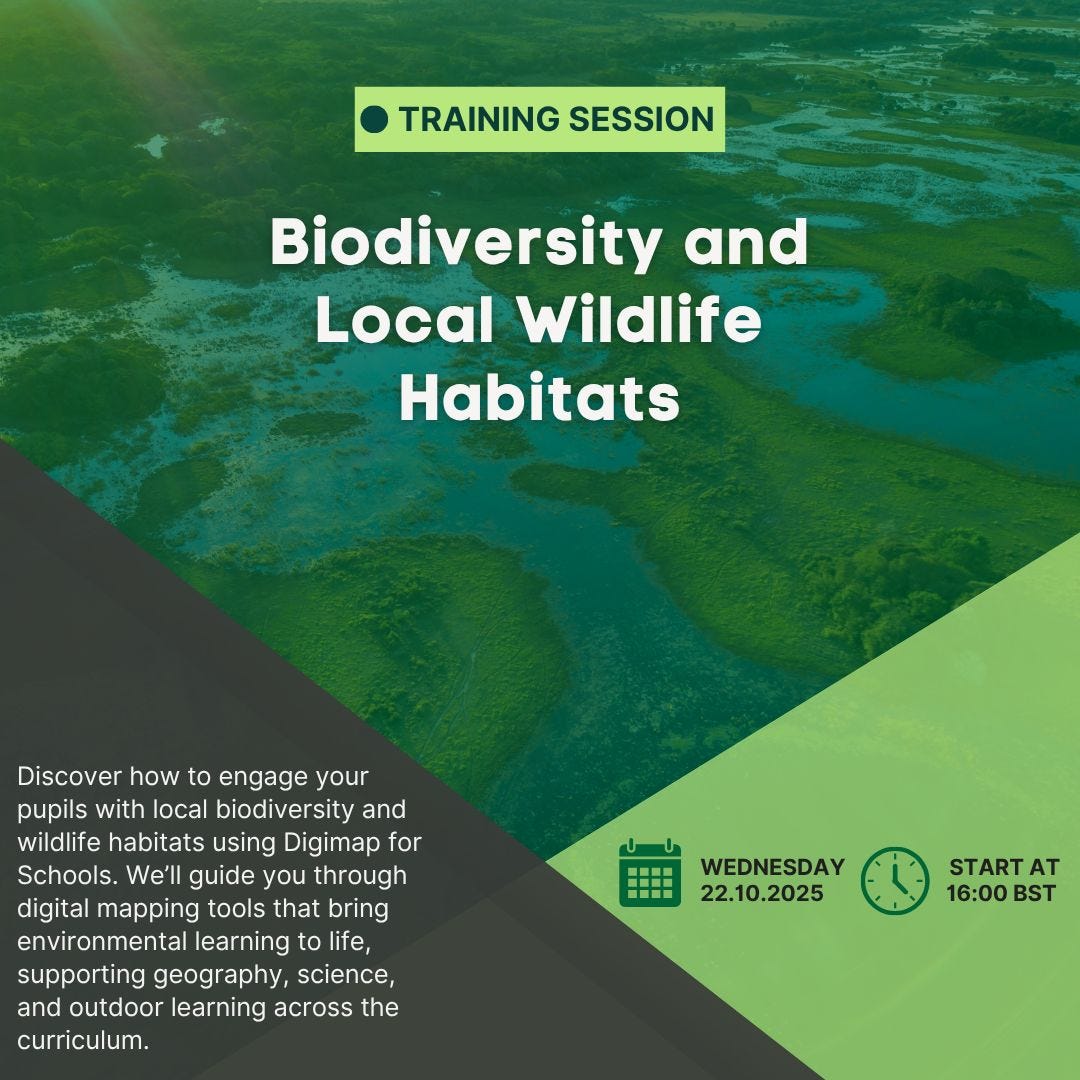
#502: Digimap CPD on mapping local wildlife and biodiversity

A free Digimap for Schools Webinar to help you explore biodiversity and local wildlife habitats. 

This sort of CPD will be valuable for those who have aspirations to teach the new specification.

No alternative text description for this image

Sign up here - it’s free.

Thursday, 25 September 2025

#496: Feral Atlas

The Feral Atlas was a tipoff from Emily Hayes.


From the site's description:

Feral Atlas invites you to explore the ecological worlds created when nonhuman entities become tangled up with human infrastructure projects. Seventy-nine field reports from scientists, humanists, and artists show you how to recognize “feral” ecologies, that is, ecologies that have been encouraged by human-built infrastructures, but which have developed and spread beyond human control. These infrastructural effects, Feral Atlas argues, are the Anthropocene.

Playful, political, and insistently attuned to more-than-human histories, Feral Atlas does more than catalog sites of imperial and industrial ruin. Stretching conventional notions of maps and mapping, it draws on the relational potential of the digital to offer new ways of analyzing—and apprehending—the Anthropocene; while acknowledging danger, it demonstrates how in situ observation and transdisciplinary collaboration can cultivate vital forms of recognition and response to the urgent environmental challenges of our times.

Thursday, 28 November 2024

#405: Biome viewer

Thanks to Hannah Steel for the link to this useful visualisation tool.

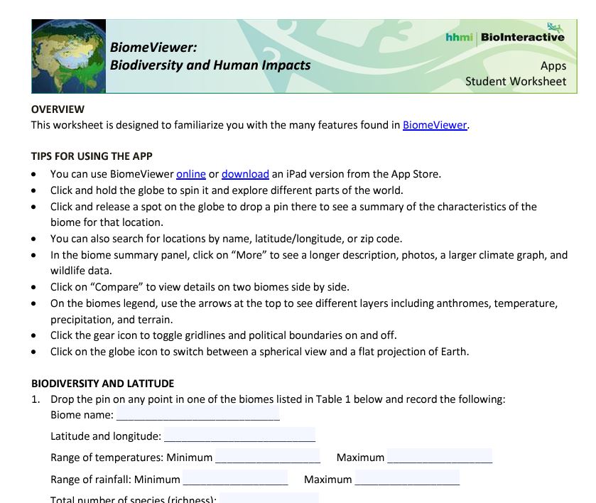
Biomeviewer displays a range of information in a visual way.

It's really useful for identifying biomes in a general way, and rotating the globe to see where they are located and identifying their characteristics.

There are accompanying resources in a folder, student worksheet and apparently an iOS app too.

The worksheet takes students through the various features which are built into the app.


You can also explore anthromes: anthropogenic biomes. These are where the majority of humanity lives.

A classification proposed by E.C. Ellis, October 25, 2005 lists them. Minimum mapping scale greater than or equal to one square kilometer.


There is a lot more information and some useful maps on this website too, which is the new home of the previous link. Lovely work and I now want to do something with this as well...

Friday, 15 November 2024

#396: Living England 2022-3 Habitat Map

Visit the link, and see the details in the technical report.


Friday, 9 August 2024

#354: Saltmarshes

An interesting piece in Geographical magazine looked at the vital role that saltmarshes will play in mitigating sea level rise caused by Climate change.

I am fortunate to live in Norfolk and can be at a salt marsh within 25 minutes of leaving my home. They are wonderful places and last month came into bloom with sea lavender and other plants cloaking them in colour.


You can find their locations using the MAGIC application which I have blogged about here separately.

Image: Flowering plants on salt marsh in Norfolk, by Alan Parkinson, shared under CC license.

Tuesday, 2 April 2024

#274: Placename Mapper - looking for natural influences

A nice mapping project shared by R T Wilson.

Thanks to Alasdair Rae for the tipoff.

This could be useful to investigate the influence of natural landscapes on place names.

There are also some historical suffixes relating to the origins of settlements e.g. I was born in Wickersley - ley means a clearing in a woodland or forest. I am reminded of this when I visit Iceland, as place names are very descriptive and include elements which tell you about the origins of the settlement.

You can search for particular words at the beginning / end etc. of place names and add several layers in different colours (which you choose) to show comparisons.

Here's a map showing place names with WOOD in their name, for example. What can you come up with?

Why not buy them a coffee for their hard work! 

Thursday, 22 February 2024

#242: MAGiC Map - a free resource for GIS work

MAGiC is an interactive map. It is produced by DEFRA with a range of other organisations.

The GI stands for Geography Information - it's a GIS.

There are a series of layers of information which can be added to the base map.

Here's a map made by turning on the Habitats > Coastal > Saltmarshes layer, for example. This is very easy to do and students could be asked to explore the map themselves or be given a step by step guide. It would make sense

This map shows the locations of saltmarshes around the Wash.


Similar maps can be created for a whole range of habitats by changing the overlays.

A general guide to the map is available here.

Tuesday, 30 January 2024

#229: Hedges in the news

Hedges were in the news with a report on the BBC News website by Helen Briggs saying that the length of the UK's hedgerows would go round the world ten times. It's based on some CEH data here.


Of course it used to be many times more, but miles of hedgerows have been lost - grubbed up to make more space, or to make larger fields to make farming more 'efficient'. Hopefully some protections are now put in place, and other new hedgerows can be planted - I noticed some going in on the edge of my Norfolk village last weekend.

The news article was picked up by a few Twitter accounts.

There are plenty of overlaps with the potential content of the GCSE Natural History specification. Hedges are a linear habitat. Their existence reveals landscape change and links to the past, including enclosure. They are important for biodiversity, and vary in form in different counties.

Hedgelink has also shared the link to the mapping which has been done by CEH. 

A comment on hedges from Robert MacFarlane to end this post. We will certainly be coming back to consider how we can create a resource related to the changing history of hedges. They need to be conserved and cherished according to this FT piece.

I like the description here by Robert of hedges:

He asked for contributions on the theme of hedges, and here is one that caught the eye, and is worth returning to:


Update

Hedgerow schemes were featured on the BBC's Countyfile programme. There are some lovely quotes about the value of hedges in this feature on hedgerow restoration. 

The piece explores what makes a good hedge.

They have been part of our landscape since the Bronze Age, but more than half have been lost since the Second World War. Watch from 27 minutes in.

Tuesday, 5 December 2023

#194: Good work

Ronald Good was an eminent Dorset botanist and author of A Geographical Handbook of the Dorset Flora (1948)

The Flora was the result of an extensive botanical survey carried out between the years 1931 and 1939.

Professor Good collected plant lists from over 7,500 stands and recorded over a quarter million plant records. 

From these he mapped the distribution of some 600 of the 1,300 flowering plants in Dorset. His book was heralded in Nature (No. 4152, May 28, 1949) as an original and valuable contribution to plant geography, and a signpost to new pastures for the field botanist.

The Good Archive is a website which is part of the Dorset Environment Research Centre's website.

The data has been added to the new Dorset Explorer. Add layers and explore the data.

One of a number of regional and county-based directories that probably exist; the results of a lifetime of study saved for others to interrogate and use.

Sunday, 26 November 2023

#190: 'Local'

Out in January 2024, the latest book from Al Humphreys will be published.

After years of expeditions all over the world, adventurer Alastair Humphreys spends a year exploring the detailed local map around his home.

Can this unassuming landscape, marked by the glow of city lights and the hum of busy roads, hold any surprises for the world traveller or satisfy his wanderlust? Could a single map provide a lifetime of exploration?

Discovering more about the natural world than in all his years in remote environments, he learns the value of truly getting to know his neighbourhood.

An ode to slowing down, Local is a celebration of curiosity and time spent outdoors, as well as a rallying cry to protect the wild places on our doorstep.

This sounds like it might have some good connections with the ideas in the GCSE Natural History.

Why not get out your own local OS sheet?
Mine is OS Explorer 238. 

There's certainly plenty of interest on that map sheet alone that could keep you going. An Explorer sheet covers an area of hundreds of square kilometres which would certainly take more than a year to thoroughly explore.


This is an area I may return to myself.

I have my copy and can confirm it's a really good read and have already made a few notes and downloaded a few apps that Al recomments, some of which will appear on this blog.

Thursday, 23 November 2023

#183: Ordnance Survey survey on mapping and GIS

My hope would be that the new specification will involve an expectation of a deal of mapwork using the Ordnance Survey's mapping, plus ESRI GIS mapping and Survey123 for the collection and visualisation of fieldwork data. They may also need to use the MAGIC map, maps of National Landscapes etc and ensure that location and description of context is an important part when considering the range of habitats and how the landscape and Natural History of the UK has changed over the centuries.

I've been involved with the OS in numerous ways over the years: as a GetOutside Champion, author of support resources for Digimap for Schools and Digimap for Colleges / Mapstream. Also as an author of articles for Mapping News and other support for various campaigns and activities.

For many years Ordnance Survey has delivered support for education to encourage the awareness and use of high-quality geospatial data in the education sector and since 2020 this has been through an Education Plan, funded through the UK Government's Geospatial Commission (GC).
They are keen to gather evidence about how this has so far supported the work of teachers and consider what more they could be doing in this area. 

They would also like to understand what other training tools geography teachers currently access and the barriers that may be in place when using geographic information systems (GIS).

They are asking for 15 minutes (or so) of your time to complete a short survey. 

The survey is open to all geography teachers until Friday 8 December and the findings from it will help them to consider how to develop the Education Plan.

Sunday, 5 November 2023

#166: Dudley Stamp's maps revisited

Cross-posting from my GA Presidents blog. Dudley Stamp was a former President of the GA.

Thanks to Steve Brace for the link to a new research project making use of Dudley Stamp's Land Utilisation Survey UK project. This involved thousands of school students mapping the area around their school and home.

The full piece in 'The Conversation' explores a new project. 

The outcomes are reported in this research paper. (Open Access at the time of posting).


We estimate that roughly 90% of lowland meadow and pasture has been lost. Land was converted either to arable farmland, which saw a 22% increase, or to agriculturally improved grassland, which now occupies 27% of Britain’s land area.

Urbanisation saw the nation’s built area expand from 4% to 5%. And woodland cover doubled from 6% to 12%, largely due to a concerted effort to increase the country’s reserve of timber. For better or worse, the nation’s land use became less mixed and more consolidated.

All of this environmental change is thought to have had a profound effect on biodiversity. According to the recent State of Nature Report, the abundance of UK species has declined by an average of 19% since 1970. Some 1,500 species (or 16% of those analysed) are now threatened with national extinction.

The full piece outlines further changes affecting particular species and how the data can help to identify species at particular risk from climate change.

All the maps are available for free download.

Thursday, 2 November 2023

#158: Ancient Earth

Exploring the development of the world's continents and its changing tectonic history is part of the suggested specification.

Check out the map here.
About 300 million years ago, Earth didn't have seven continents, but instead one massive supercontinent called Pangaea, which was surrounded by a single ocean called Panthalassa.


This would go well along with the Ancient Earth map, which allows you to go back through phases of life on Earth.


This is an interesting area of the proposed specification. I will be interested to see whether this remains in the final document as it is quite a different period of natural history - when certain species emerged for the first time according to evidence in the fossil record.

Thursday, 19 October 2023

#134: Village Green Preservation Society

A guide to finding village greens on MAGiC maps. I've blogged about MAGiC maps before.

Village Greens are one of the entries in Common Ground's 'England in Particular' as well. They are an important element of rural life for many, and also a habitat for wildlife.


Many village greens are protected, as they are part of the landscape character of the area.

The Open Spaces Society protects village greens and similar open spaces.

My own village has a small village green which the local pub has appropriated with tables during good weather. There is a notice board and a few wooden posts to put vehicles off driving onto it. Other local villages have more substantial spaces.

Kate Rusby's version of the song was also the theme music for a comedy series called 'Jam and Jerusalem'.
 

I have a green in my village which is quite small, but is a nice protected space, with seats and a village notice board.

A local green might make an easy destination for a visit and bio-blitz... or to put up a sign inviting local wildlife experts to contact the school if they want to help the students identify their particular area of interest.

#643: The Path More Travelled

A cross posting from my Geo Library blog project - what do you mean you haven't visited? There's over 700 books that would be of in...